A classic Park City climb through aspens with two practical cut-offs (Dawn's and HAM) so you can choose how long a day you want — plus what you'll actually see between the parking lot and the ridge.
Distance
4–6 mi RT
Elevation
800–1,000 ft
Time
2–3 hrs
Type
Loop
Difficulty
Easy-Moderate
Dogson-leash (PC ordinance)Bikesuphill only on Armstrong; multi-directional on SpiroShadeWinter accesssnowshoeable but less popular than Rob's
Season
Jan
Feb
Mar
Apr
May
Jun
Jul
Aug
Sep
Oct
Nov
Dec
PeakOpen
Start
7,000 ft
Peak
8,150 ft
Gain
1,150 ft
One way
3.8 mi
Armstrong is the trail we send people to when they want a real climb but also want to be able to say "okay, that's enough" partway up and find their way home. Most Park City climbs are commit-or-bail; Armstrong has two clean cut-offs built in. That's what makes it work for almost anyone — you can hike four miles or you can hike six, and either way you got the views.
It's also one of the prettier aspen trails on the PCMR side. The lower half is mostly shaded forest, the middle opens up under ski runs you'll recognize if you ski here in winter, and the top spits you out at Mid-Mountain Trail at around 8,150 feet. The grade is gradual the whole way up. No scrambling, no technical sections, nothing exposed.
A note before you start: Armstrong is uphill-only for bikes. You'll share the lower trail with climbing riders, and they appreciate it if you step off to the downhill side when they're working hard up a switchback. Above the HAM cut-off, the trail's quieter — most riders peel off at HAM to descend Spiro.
Getting there
The trailhead is at Silver Star, near the base of the Silver Star chairlift on the north side of Park City Mountain Resort. Here's the thing: parking at Silver Star itself is highly discouraged. The lot is tiny and meant for the cafe and lift access. Don't park there.
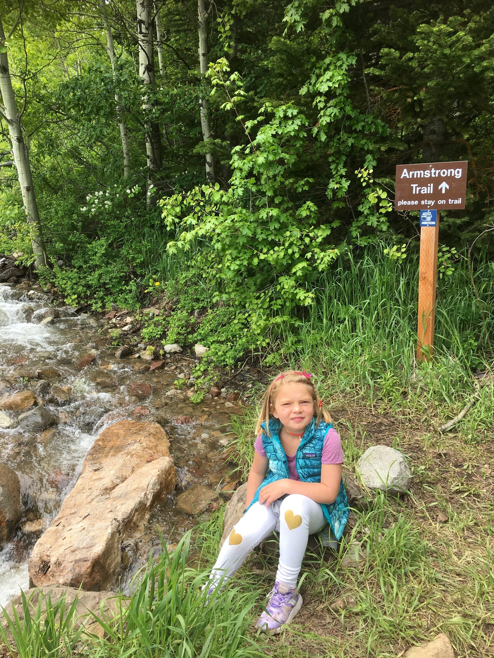
Instead, park in the main PCMR lot and walk in. From the PCMR base, head north up Three Kings Drive. After about 0.3 miles you'll see Silver Star Café on the right — the trail starts just past it, where you'll see a small gravel area and signs for Armstrong, Spiro, and Silver Spur all peeling off together.
From the PCMR lot, you'll add roughly 0.6 miles of pavement walking round-trip to your day. Worth it for not getting a parking ticket.
Driving from Park City Main Street:
hikingtrail guidepcmr sideaspens
Shoulder
Snowshoe
Head south on Park Avenue
Continue as Park Avenue becomes Lowell Avenue
Turn into the main PCMR parking lot (the big one at 1345 Lowell Ave)
Walk north on Three Kings Drive about 0.3 miles to the Silver Star trailhead
The hike, with three places to decide what kind of day you want
From the Silver Star trailhead, Armstrong splits off to the right almost immediately. Spiro splits left — don't take it; Spiro is two-way for bikes and you'll spend the whole climb dodging downhillers. Stay right on Armstrong.
The first mile is shaded forest — aspens, evergreens, and a steady gentle climb on smooth singletrack. You'll cross under the Eagle chairlift and start working your way around the lower mountain. This section is the cool one in July and August.
Decision point 1: Dawn's Trail (2.1 miles in)
About two miles up, Dawn's Trail forks off to the left. If you're hiking with kids, a dog that's done enough, or you just don't feel like going much higher, this is the cut-off to take.
Dawn's drops you back to Silver Star in 1.8 miles. It's a newer trail (built 2014), generally drier than the upper Armstrong sections, and the descent is gentle enough that you won't beat up your knees. Total day if you do this: roughly 4 miles, 800 feet of climbing, back to the car in about two hours.
This is the loop most first-time visitors do, and it's a legitimately good day out. You're not missing anything spectacular up higher — just more of the same forest and aspens.
If you're staying on Armstrong, keep right at the Dawn's junction.
Decision point 2: HAM Trail (about 3 miles in)
Another mile or so past the Dawn's split, HAM Trail peels off to the left. HAM is a short connector — roughly 0.6 miles — that drops you onto Spiro for the descent back to Silver Star.
HAM exists because the upper third of Armstrong is genuinely the steepest section, and a lot of mountain bikers and hikers don't want to commit to the full top-out. If you've gotten to the HAM junction and the legs are saying enough, this is the cut-off that doesn't make you backtrack.
Taking HAM down and Spiro back gives you a total day of roughly 6 miles, 1,000 feet of climbing. The Spiro descent is fun but heads up: Spiro is multi-directional for bikes, so you'll meet downhillers head-on. Step off the trail when you hear or see them coming.
Decision point 3: keep going to Mid-Mountain (3.8 miles in)
If you stay on Armstrong past HAM, you'll climb another 0.8 miles or so to the Mid-Mountain Trail junction at roughly 8,150 feet. Mid-Mountain is the contour trail that runs across the entire ski resort area — from here you could keep going for hours in either direction if you wanted to.
For most hikers, the top of Armstrong is the natural turnaround. You've earned the view, you've done the climb, and now you have to figure out how to get back. The honest options:
Retrace Armstrong — not allowed for bikes (uphill-only), but fine for hikers. You'll be going against the climbing flow, so stay alert and step off when you hear bikes coming up. Adds 3.8 miles back the way you came.
Take Mid-Mountain south a short distance, then descend Spiro — the classic Armstrong-Spiro loop. This is what most mountain bikers do. It's about 6 miles of descent back to the car, total day around 10 miles with 1,600 feet of gain.
Connect further into the network — Mid-Mountain links to Rob's Trail (north), Pinecone Ridge, and a dozen other trails. Best for hikers who want a long day and a shuttle pickup at a different trailhead.
The full Armstrong-to-Mid-Mountain-to-Spiro loop is genuinely a big day. If you're not used to hiking at altitude, the HAM cut-off is the smarter call.
What you'll see along the way
The character of the trail shifts as you climb:
Lower section (first mile): Mostly forested — aspens, evergreens, scrub oak. Shaded, cool even on hot afternoons. You'll cross under the Eagle chairlift.
Middle section (between Dawn's and HAM cut-offs): This is the prettiest stretch. The trail opens up at the bottom of the King Con chairlift area, gives you the first real views east toward the Snyderville Basin, then dives back into forest with switchbacks through aspen groves. In fall, this is the section that draws photographers.
Upper section (HAM to Mid-Mountain): Steeper, more open, mixed aspen and conifer. The views get wider the higher you climb. By the time you hit Mid-Mountain, you're looking across multiple ski runs and out toward the Wasatch range.
Wildflowers and color: Summer brings Indian Paintbrush, columbine, lupine, and other Utah wildflowers along the trail edges. Fall is when Armstrong really earns its reputation — the aspen groves between the cut-offs go gold in late September and early October. Peak color in Park City usually lands in the last week of September through the first two weeks of October, but it shifts year to year.
If you do one fall hike in Park City and you've already done Rob's, do Armstrong. The aspen sections are the photo.
When to hike it
Early summer (June): Some years the upper trail still has muddy or snowy patches into early June. Lower Armstrong (to the Dawn's cut-off) opens earlier and is reliable from mid-May onward.
Peak summer (July–August): The shaded lower section is a real advantage on hot afternoons. The trail gets busy, especially on weekends. Go early; bring water; watch for thunderstorms above the Dawn's cut-off in afternoons.
Fall (September–mid-October): Prime time. Cool mornings, golden aspens, lower bike traffic. Best window in PC for hiking.
Late fall (late October): Trail's still open but conditions get unreliable. Mud, frost, and possible early snow above HAM.
Winter (December–March): Snowshoeable. The lower Armstrong-to-Dawn's loop is the more popular winter outing on this trail — it's well-traveled by snowshoers and the grade is friendly. Less popular than Rob's Trail for snowshoeing, mostly because parking at PCMR is busier in winter (it's the ski lot) and the trail is in the ski resort's active footprint, which feels less peaceful than Rob's. Doable, just different.
Shoulder seasons (November, April, mid-May): The worst time for any PC trail. Mud, refreezing, surface damage. Wait it out.
What to bring
Water — altitude makes you thirstier than you think
Sun protection — the open sections get full sun by mid-morning
Layers — the top is 15-20°F cooler than the parking lot
Leash for your dog
Awareness for moose — they're around in this drainage too
Bike awareness — even hiking, Armstrong is bike-shared on the way up; Spiro is bike-shared in both directions
Moose live in this drainage. Give at least 50 feet, more if you can. They're not aggressive by default, but cows with calves will charge if cornered. If you see one on the trail, wait or back away calmly.
After the hike
If you're heading back to Old Town from the PCMR base, the drive's only about ten minutes — grab a coffee at one of the Main Street spots before walking the street. If you're driving the other way toward I-80, Hugo Coffee at Kimball Junction is a woman-owned roaster that's openly dog-friendly and puts proceeds toward animal rescue.
If you're staying near PCMR, Silver Star Café is right at the trailhead and serves breakfast and lunch year-round — that's the easy after-hike spot if you don't feel like driving.
Frequently asked questions
How long is Armstrong Trail?
Depends on which loop you do. The shortest is Armstrong to Dawn's and back to Silver Star — about 4 miles. Taking HAM down to Spiro is about 6 miles. Going all the way to the Mid-Mountain junction and back via Spiro is roughly 10 miles.
How hard is Armstrong Trail?
Moderate. The grade is steady but never steep, the surface is smooth, and there's no scrambling or exposure. The biggest factor is altitude — you're hiking between 7,000 and 8,150 feet. Visitors from sea level should give themselves a day to acclimate.
Can you bring dogs on Armstrong?
Yes, on-leash, per Park City municipal ordinance. The lower trail is heavily bike-shared, so an early start is much more comfortable for dogs (and bikers).
Where's the Armstrong trailhead?
Officially at Silver Star, near the base of the Silver Star chairlift on the north side of Park City Mountain Resort. In practice, park in the main PCMR lot (1345 Lowell Ave) and walk up Three Kings Drive about 0.3 miles to reach the trailhead. Parking at Silver Star directly is highly discouraged.
Is Armstrong open year-round?
Yes for hiking and snowshoeing. The trail itself doesn't close. It's most popular June through October; winter is snowshoe-able but less crowded than summer.
Can you mountain bike Armstrong?
Yes, uphill-only. Armstrong was built specifically as the directional climbing trail so Spiro could be the downhill. Bikers ascending Armstrong typically descend via Spiro, HAM, or Dawn's.
What's the elevation gain?
Roughly 800 feet to the Dawn's cut-off (shorter loop), about 1,000 feet to the HAM junction, and around 1,300 feet to the top at the Mid-Mountain Trail junction.
What are the cut-offs?
Two practical ones: Dawn's Trail at about 2 miles in (drops back to Silver Star in 1.8 miles, easy descent), and HAM Trail at about 3 miles in (0.6-mile connector to Spiro, which descends back to Silver Star). Both exist so you don't have to commit to the full climb if you don't want to.
Is Armstrong good for kids?
Yes, especially the Armstrong-Dawn's loop. The grade is gentle, the trail is shaded, and 4 miles is reasonable for most kids over 7 or 8. Bike traffic is the main thing to watch — keep kids alert and to the side of the trail when bikes are coming.